Looking back at an eventful and inspiring AESOP YA Conference 2025
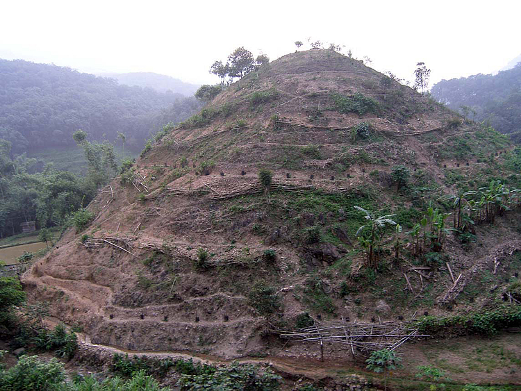
Living Landscapes China (LILAC): Rural development through land use diversification: actor-based strategies and integrative technologies for agricultural landscapes in southwest China's mountainous region.
| Led by: | PD Dr. Sylvia Herrmann, Dr. Karin Berkhoff |
| Team: | Dipl.-Ing. Johanna Scholz |
| Year: | 2010 |
| Funding: | Bundesministerium für Bildung und Forschung (BMBF) |
| Duration: | 2007 - 2010 |
| Is Finished: | yes |
Abstract LUCC ( LILAC)
GIS based modelling approaches are used to map future changes in the land use pattern to be expected in the research area due to the interaction of social, economic and ecological processes. These approaches allow for a spatially explicit visualisation of potential developments in terms of scenarios.
Subproject LUCC (land use modelling) at the Leibniz University Hannover develops a model for regional analysis of land use change (based on the CLUE approach) for the Nabanhe watershed. CLUE is a hybrid methodology combining different methodological approaches (Statistical Analysis, Decision Rules, Cellular Automata, Markov Chains). The specification depends on scale, land use processes, and case study area.
The background of the modelling procedure is the spatial localisation of land use changes in the past as well as the detailed appraisal of economic, ecological and social factors determining the future land use changes. The latter will be implemented in the model by a set of decision rules.
Subproject LUCC will create a model cluster by defining interfaces between the LUCC model and models of other subprojects. This coupling enables the integration of all relevant aspects of land use, and the evaluation of the ecological, agro-economic and social effects arising from the different scenarios calculated by the LUCC model.
Accordingly, the model cluster provides means for the optimisation of land use planning and supports the development of sustainable land use strategies.
Furthermore, subproject LUCC is responsible for the central GIS and data base coordination of the project as well as for the provision of data derived from remote sensing information.
Contact: PD Dr. Sylvia Herrmann